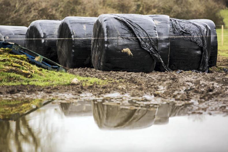
Bails that were flooded sit behind a flooded driveway / Philip Doyle.
ADVERTISEMENT
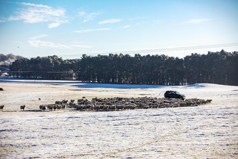
Monday
Met Éireann has forecast heavy rain for Monday with rain clearing eastwards later in the day but remaining showery in the west.
Temperatures will be between 2°C and 5°C.
ADVERTISEMENT
Tuesday
Heavy hail and thunder across parts of the country with strong westerly winds reaching gale force overnight.
Minimum temperatures will reach between 3°C and 5°C.
Wednesday
Another cold start to the day with some outbreaks of sunshine and winds gradually easing through the day.
However, western counties will get hit by a rain belt from the Atlantic and outbreaks of rain will move eastwards.
Minimum temperatures between 6°C and 8°C.
Thursday and Friday
An unsettled day with intermittent showers of rain on both days.
Temperatures are expected to dip below the March average.
Farming forecast
Rain
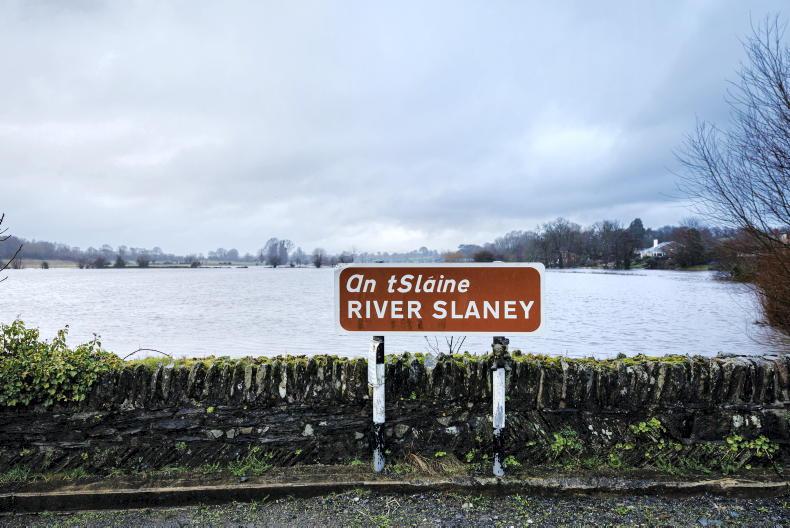
According to Met Éireann, rainfall has been up to three times the norm over the last week. This trend is expected to continue as more rain and hail is forecast for the week ahead.
Field conditions
Most farmers won’t have to be told that Met Éireann’s current indications are that most soils are currently saturated and poorly drained soils are waterlogged.
This content is available to digital subscribers and loyalty code users only. Sign in to your account, use the code or subscribe to get unlimited access.
The reader loyalty code gives you full access to the site from when you enter it until the following Wednesday at 9pm. Find your unique code on the back page of Irish Country Living every week.
CODE ACCEPTED
You have full access to the site until next Wednesday at 9pm.
CODE NOT VALID
Please try again or contact support.
Monday
Met Éireann has forecast heavy rain for Monday with rain clearing eastwards later in the day but remaining showery in the west.
Temperatures will be between 2°C and 5°C.
Tuesday
Heavy hail and thunder across parts of the country with strong westerly winds reaching gale force overnight.
Minimum temperatures will reach between 3°C and 5°C.
Wednesday
Another cold start to the day with some outbreaks of sunshine and winds gradually easing through the day.
However, western counties will get hit by a rain belt from the Atlantic and outbreaks of rain will move eastwards.
Minimum temperatures between 6°C and 8°C.
Thursday and Friday
An unsettled day with intermittent showers of rain on both days.
Temperatures are expected to dip below the March average.
Farming forecast
Rain
According to Met Éireann, rainfall has been up to three times the norm over the last week. This trend is expected to continue as more rain and hail is forecast for the week ahead.
Field conditions
Most farmers won’t have to be told that Met Éireann’s current indications are that most soils are currently saturated and poorly drained soils are waterlogged.
If you would like to speak to a member of our team, please call us on 01-4199525.
Link sent to your email address
We have sent an email to your address. Please click on the link in this email to reset your password. If you can't find it in your inbox, please check your spam folder. If you can't find the email, please call us on 01-4199525.
ENTER YOUR LOYALTY CODE:
The reader loyalty code gives you full access to the site from when you enter it until the following Wednesday at 9pm. Find your unique code on the back page of Irish Country Living every week.


SHARING OPTIONS