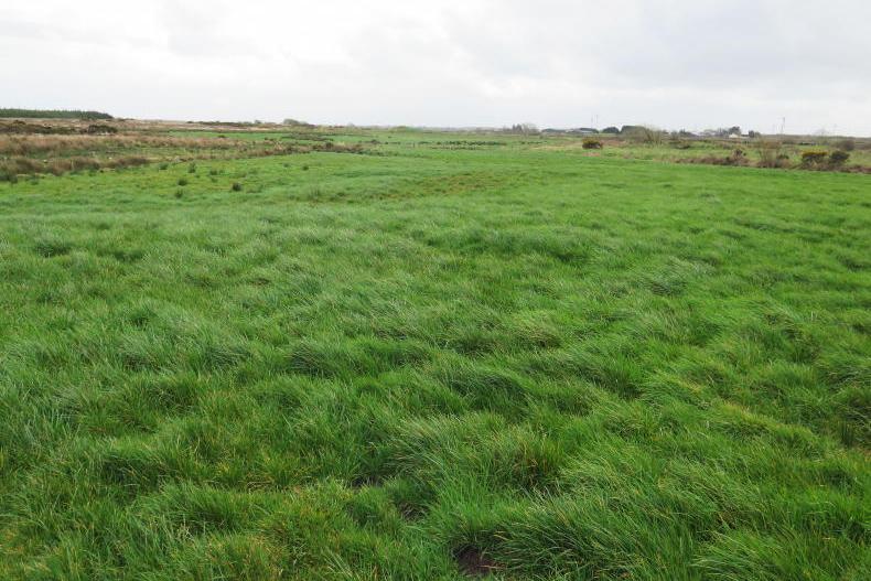
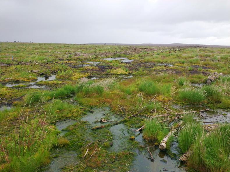
There is approximately 650,000ha of lands classified as peat soils and subject to GAEC 2 regulations.
ADVERTISEMENT
Farmers wishing to check if their land is categorised as a peat soil and subject to the new GAEC 2 legislation can now find this information through the Department of Agriculture’s agfood.ie facility.
The information is available through the mapping system in the Basic Income Support for Sustainability (BISS) portal and can be accessed by activating the peat layer.
There are a few steps that need to be taken to access the information and below is a step-by-step guide to completing this process. The system is easiest to view if working on a desktop computer or tablet.
ADVERTISEMENT
Step 1 - accessing the mapping system
The mapping system can be accessed by starting this year’s BISS application or accessing it via last year’s application.
The first option is relatively straightforward and begins with clicking on the 'start application' button under 'Application for BISS 2025'.
This brings you through to the screen detailing if you are deemed an active farmer – select 'next' in the bottom right corner.
This brings you through to the scheme selection web page. The action taken by most farmers completing their own BISS is to confirm participation in the Areas of Natural Constraint. Scroll down to the bottom of the page and click 'next'.
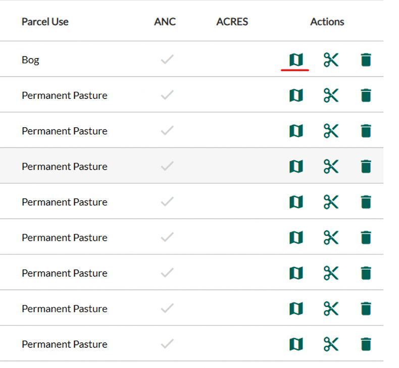
This then brings you through to the ‘Land details’ web page and is where you access the mapping system. To access the mapping system, click on the map symbol underlined red in Figure 1.
Figure 1 - the mapping system can be accessed by clicking on the map symbol underlined red.
Step 2 – activating the peat layer
Once on the mapping page, scroll over to the right-hand side of the screen.
Information on the parcel concerned will be listed here. At the top of this information, there is two tabs – 'Info and Layers'. Click on the 'layers' tab.
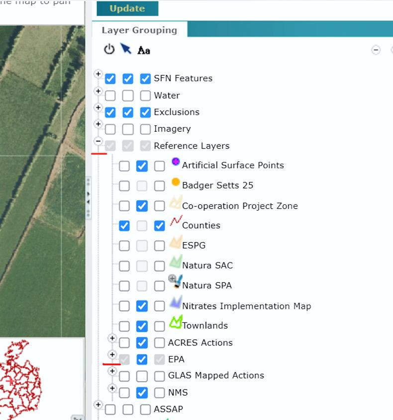
This will bring up a long list of options. The seventh listing is 'EPA'. There is a small plus [+] symbol to the left of this – click on this.
This will present the expanded listing shown in Figure 2. The next process is clicking the plus [+] symbol to the left of EPA. These two headings are underlined red in Figure 2.
Figure 2 - the + symbol at the side of the listing presents an expanded list of layers.
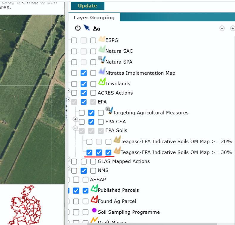
This will expand to two further options called Teagasc-EPA Indicative soils – select the bottom option for >=30% organic matter.
The second Teagasc organic matter soil layer can be activated by clicking on the three boxes.
Scroll back up to the top of this section and then click on 'Update'.
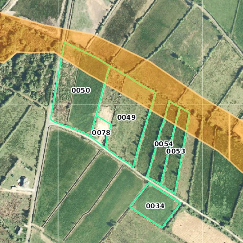
This will activate the peat soil layer which is shown as a brown shading across lands as demonstrated in Figure 4.
Figure 4 - the brown shaded layer shows peat soils subject to GAEC regulations.
The tab at the left of the map screen can be used to change the scale of the map which is a useful way to look at more land parcels.
Step 3 – returning to land details
To return to the LPIS parcel page, select the option 'Return to Land Details' on the left of the page.
This content is available to digital subscribers and loyalty code users only. Sign in to your account, use the code or subscribe to get unlimited access.
The reader loyalty code gives you full access to the site from when you enter it until the following Wednesday at 9pm. Find your unique code on the back page of Irish Country Living every week.
CODE ACCEPTED
You have full access to the site until next Wednesday at 9pm.
CODE NOT VALID
Please try again or contact support.
Farmers wishing to check if their land is categorised as a peat soil and subject to the new GAEC 2 legislation can now find this information through the Department of Agriculture’s agfood.ie facility.
The information is available through the mapping system in the Basic Income Support for Sustainability (BISS) portal and can be accessed by activating the peat layer.
There are a few steps that need to be taken to access the information and below is a step-by-step guide to completing this process. The system is easiest to view if working on a desktop computer or tablet.
Step 1 - accessing the mapping system
The mapping system can be accessed by starting this year’s BISS application or accessing it via last year’s application.
The first option is relatively straightforward and begins with clicking on the 'start application' button under 'Application for BISS 2025'.
This brings you through to the screen detailing if you are deemed an active farmer – select 'next' in the bottom right corner.
This brings you through to the scheme selection web page. The action taken by most farmers completing their own BISS is to confirm participation in the Areas of Natural Constraint. Scroll down to the bottom of the page and click 'next'.
This then brings you through to the ‘Land details’ web page and is where you access the mapping system. To access the mapping system, click on the map symbol underlined red in Figure 1.
Figure 1 - the mapping system can be accessed by clicking on the map symbol underlined red.
Step 2 – activating the peat layer
Once on the mapping page, scroll over to the right-hand side of the screen.
Information on the parcel concerned will be listed here. At the top of this information, there is two tabs – 'Info and Layers'. Click on the 'layers' tab.
This will bring up a long list of options. The seventh listing is 'EPA'. There is a small plus [+] symbol to the left of this – click on this.
This will present the expanded listing shown in Figure 2. The next process is clicking the plus [+] symbol to the left of EPA. These two headings are underlined red in Figure 2.
Figure 2 - the + symbol at the side of the listing presents an expanded list of layers.
This will expand to two further options called Teagasc-EPA Indicative soils – select the bottom option for >=30% organic matter.
The second Teagasc organic matter soil layer can be activated by clicking on the three boxes.
Scroll back up to the top of this section and then click on 'Update'.
This will activate the peat soil layer which is shown as a brown shading across lands as demonstrated in Figure 4.
Figure 4 - the brown shaded layer shows peat soils subject to GAEC regulations.
The tab at the left of the map screen can be used to change the scale of the map which is a useful way to look at more land parcels.
Step 3 – returning to land details
To return to the LPIS parcel page, select the option 'Return to Land Details' on the left of the page.
If you would like to speak to a member of our team, please call us on 01-4199525.
Link sent to your email address
We have sent an email to your address. Please click on the link in this email to reset your password. If you can't find it in your inbox, please check your spam folder. If you can't find the email, please call us on 01-4199525.
ENTER YOUR LOYALTY CODE:
The reader loyalty code gives you full access to the site from when you enter it until the following Wednesday at 9pm. Find your unique code on the back page of Irish Country Living every week.


SHARING OPTIONS