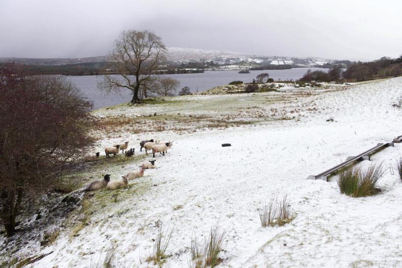
Speaking on RTE Radio One’s morning Ireland, Evelyn Cusack of Met Éireann issued a stark warning about snow fall levels across the country, starting on Tuesday evening.
She said: "On Tuesday night a cold front will move across the Irish Sea, starting off as rain and then turning increasingly to snow.
"By Wednesday morning there is likely to be a fair amount of snow an eastern coastal counties.”
ADVERTISEMENT
Cusack also said on Wednesday evening and night and Thursday morning “snow showers will come in from the Irish Sea but not so many in the west but further east there will be a higher deposit of snow”.
Dynamic snow weather system
She said “the high danger area for countrywide will be Thursday evening, Thursday night and Friday morning. As a dynamic snow weather system with a lot of precipitation is pushing up from the bay of Biscay and hits Ireland, there is high risk of some very heavy snow.”
She also warned of easterly gales which will bring blizzard-like conditions, with powdery snow.
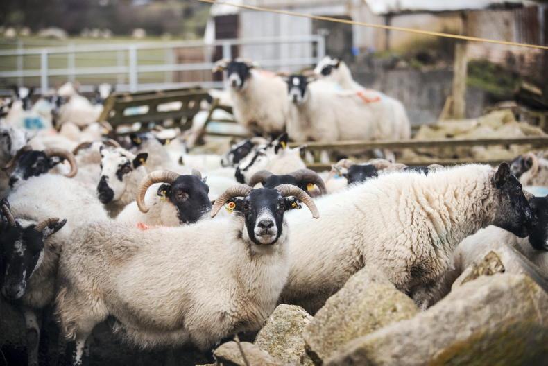
Cusack went on to say that wind chill will be of concern to farmers as it will affect animals such as lambs and early spring growth will be totally stopped this week.
This content is available to digital subscribers and loyalty code users only. Sign in to your account, use the code or subscribe to get unlimited access.
The reader loyalty code gives you full access to the site from when you enter it until the following Wednesday at 9pm. Find your unique code on the back page of Irish Country Living every week.
CODE ACCEPTED
You have full access to the site until next Wednesday at 9pm.
CODE NOT VALID
Please try again or contact support.
Speaking on RTE Radio One’s morning Ireland, Evelyn Cusack of Met Éireann issued a stark warning about snow fall levels across the country, starting on Tuesday evening.
She said: "On Tuesday night a cold front will move across the Irish Sea, starting off as rain and then turning increasingly to snow.
"By Wednesday morning there is likely to be a fair amount of snow an eastern coastal counties.”
Cusack also said on Wednesday evening and night and Thursday morning “snow showers will come in from the Irish Sea but not so many in the west but further east there will be a higher deposit of snow”.
Dynamic snow weather system
She said “the high danger area for countrywide will be Thursday evening, Thursday night and Friday morning. As a dynamic snow weather system with a lot of precipitation is pushing up from the bay of Biscay and hits Ireland, there is high risk of some very heavy snow.”
She also warned of easterly gales which will bring blizzard-like conditions, with powdery snow.
Cusack went on to say that wind chill will be of concern to farmers as it will affect animals such as lambs and early spring growth will be totally stopped this week.
If you would like to speak to a member of our team, please call us on 01-4199525.
Link sent to your email address
We have sent an email to your address. Please click on the link in this email to reset your password. If you can't find it in your inbox, please check your spam folder. If you can't find the email, please call us on 01-4199525.
ENTER YOUR LOYALTY CODE:
The reader loyalty code gives you full access to the site from when you enter it until the following Wednesday at 9pm. Find your unique code on the back page of Irish Country Living every week.


SHARING OPTIONS