Before we look at the seemingly inevitable changes that are coming to land use in Ireland, it is worth taking a little time to look at the current situation.
Earlier this year Tailte Eireann – formerly Ordinance Survey Ireland – published what is by far the most comprehensive and accurate land cover map of the Republic of Ireland that has ever been made. Through the use of satellite imagery and machine learning, they have measured the country with a resolution 250 times greater than the previous benchmark CORINE map used.
What the land cover map shows is that Ireland has a lot less of some of the stuff we thought was there and a lot more of other things.
The tables show the breakdown of land cover type and the charts show the breakdown of each subcomponent.
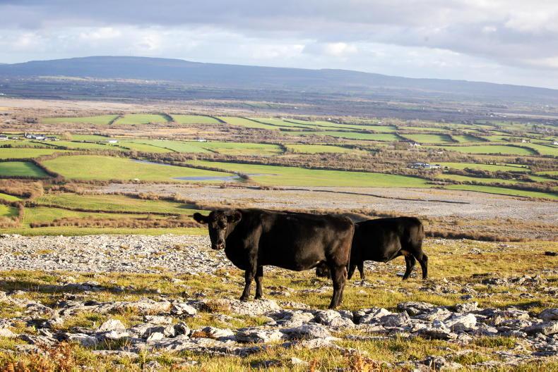
Probably the most surprising thing in the data is the relatively small amount of actual grass cover there is. We have visions of the Irish countryside being rolling hills and valleys covered in grass feeding the cattle and sheep that make up so much of Ireland’s agriculture industry.
It turns out that considerably less than half of Ireland is actually covered in improved grassland. Add in the 9% that is wet grassland (the many fields that are losing the battle to rushes) and we just barely creep through 50%.
A significant amount of the rest is made up of forestry, with the features that form part of that classification in this map accounting for over 18% of the total land cover of the country. Another big chunk goes in heather and peat covered hillside, while bogs account for much of what’s left.
Only 2% of the country has actually been built on.
With agricultural practices undergoing major changes at the moment in Ireland, knowing how much useful land there is for farming is a fundamental piece of information – one that we have only got a clear view of in the past few months.
Interestingly, in doing the map, the ordinance survey used 36 land cover classifications, with many of those unique to Ireland as they found much of the classification structure used in the rest of Europe was not applicable to this country. This is certainly a point that is worth hammering home when negotiating with Europe over land policies – Ireland really is different!
While the amount of land that is not covered by grass may come as something of a surprise, the breakdown nationally is probably more in line with preconceptions. We all know there is more tillage in Leinster than Connacht. There is more grassland in Cork than Clare.
What we certainly didn’t realise is how large the differences between counties and regions actually are. The table on the opposite page shows the percentage of land in each country that is actually used for food production – either through tillage or grassland.
There are four counties – Wicklow, Kerry, Mayo and Donegal – where less than 50% of the land area is either grassland or tillage. Dublin, surprisingly, has quite a lot of grassland, but that could be due to the inclusion of “parkland and recreational land” in the county-by-county totals presented by Tailte Éireann.
In the shaded map, we can clearly see how the amount of land that is intensively farmed drops as we move further from the southeast of the country.
This is not to say that much of the land that does not fall into the category of “grassland” is not farmed. Donegal, for example, is almost one quarter covered in “heath and bracken”, but as anyone who’s ever driven the hills of that county know, that heath and bracken hides a lot of sheep.
The national distribution of farm type shows that dairy farms are concentrated in the southern half of the country, with sheep enterprises most common in parts of the country where there is the least grass cover.
No good deed
goes unpunished
Given that such a relatively small amount of the country’s land surface is covered in productive land, it might seem there is an opportunity to expand the footprint of agriculture.
Also, the new measurements mean that Ireland has a much better environmental footprint than previously thought – the forestry cover in the Tailte map is almost double what has been reported in some other measurements.
Unfortunately, Ireland’s environmental targets are not based on the total stock of trees, biodiversity or wetlands in the country. Instead, they are based on improvements from a baseline. Because Ireland’s environmental baseline was already so high – much higher than many of us realised, it seems – the easy lifting in terms of getting the further improvements done is mostly not available.
The current legislative agenda suggests there are more rules coming – particularly the Nature Restoration Law – which put further pressure on the amount of land available for agricultural activities in Ireland.
Over the following pages, we will look at that tension between productive farming and environmental goals and see if we can get some idea about what the future might hold.
The often-quoted measurement of grassland in Ireland is “80% of Ireland is farmland and 80% of that is grass”. Eighty per cent of 80% implies that 64% of Ireland is covered in grass. While we now know that number is much closer to 50%, there is no denying that grass-growth is by far the most common land use in Ireland.
Grass-farming activities fall into either dairy, beef or sheep enterprises.
Of these, dairy is both the most intensive and the most profitable
The total area under crops in the country has been rising in the past few years while still remaining below the 300,000 hectare level seen a decade ago.
The 2020 CSO census of agriculture showed that there was more land under crops in Wexford than in the combined total of the 16 counties with the lowest cover.
Of all the land cover types, the data for forestry in the Tailte map is by far the most surprising. There are seven different sub-classifications:
Transitional forest is classified as plantations with maximum height of less than 8m so are trees that have been planted for commercial purposes in recent years
.
‘Scrub’ is defined as woody shrub vegetation dominated by immature or stunted trees not exceeding 5m in height.
Even taking scrub and hedgerows out of the calculation, we see that forestry cover in Ireland is at 13.35%, far above the 9.51% coverage given in the CORINE maps and above the 11% given by Eurostat’s European Forestry Accounts. Including hedgerows and scrub, coverage jumps to 18.27% – almost double the previous estimate.
From a European perspective, the jump in forestry cover in Ireland from 11% to over 18% hardly moves the country up the league table at all. Ireland would only gain one place on the list, passing Denmark, to become the country with the fourth lowest forestry cover in the EU. Malta and the Netherlands are the other two lower countries.
Before we look at the seemingly inevitable changes that are coming to land use in Ireland, it is worth taking a little time to look at the current situation.
Earlier this year Tailte Eireann – formerly Ordinance Survey Ireland – published what is by far the most comprehensive and accurate land cover map of the Republic of Ireland that has ever been made. Through the use of satellite imagery and machine learning, they have measured the country with a resolution 250 times greater than the previous benchmark CORINE map used.
What the land cover map shows is that Ireland has a lot less of some of the stuff we thought was there and a lot more of other things.
The tables show the breakdown of land cover type and the charts show the breakdown of each subcomponent.
Probably the most surprising thing in the data is the relatively small amount of actual grass cover there is. We have visions of the Irish countryside being rolling hills and valleys covered in grass feeding the cattle and sheep that make up so much of Ireland’s agriculture industry.
It turns out that considerably less than half of Ireland is actually covered in improved grassland. Add in the 9% that is wet grassland (the many fields that are losing the battle to rushes) and we just barely creep through 50%.
A significant amount of the rest is made up of forestry, with the features that form part of that classification in this map accounting for over 18% of the total land cover of the country. Another big chunk goes in heather and peat covered hillside, while bogs account for much of what’s left.
Only 2% of the country has actually been built on.
With agricultural practices undergoing major changes at the moment in Ireland, knowing how much useful land there is for farming is a fundamental piece of information – one that we have only got a clear view of in the past few months.
Interestingly, in doing the map, the ordinance survey used 36 land cover classifications, with many of those unique to Ireland as they found much of the classification structure used in the rest of Europe was not applicable to this country. This is certainly a point that is worth hammering home when negotiating with Europe over land policies – Ireland really is different!
While the amount of land that is not covered by grass may come as something of a surprise, the breakdown nationally is probably more in line with preconceptions. We all know there is more tillage in Leinster than Connacht. There is more grassland in Cork than Clare.
What we certainly didn’t realise is how large the differences between counties and regions actually are. The table on the opposite page shows the percentage of land in each country that is actually used for food production – either through tillage or grassland.
There are four counties – Wicklow, Kerry, Mayo and Donegal – where less than 50% of the land area is either grassland or tillage. Dublin, surprisingly, has quite a lot of grassland, but that could be due to the inclusion of “parkland and recreational land” in the county-by-county totals presented by Tailte Éireann.
In the shaded map, we can clearly see how the amount of land that is intensively farmed drops as we move further from the southeast of the country.
This is not to say that much of the land that does not fall into the category of “grassland” is not farmed. Donegal, for example, is almost one quarter covered in “heath and bracken”, but as anyone who’s ever driven the hills of that county know, that heath and bracken hides a lot of sheep.
The national distribution of farm type shows that dairy farms are concentrated in the southern half of the country, with sheep enterprises most common in parts of the country where there is the least grass cover.
No good deed
goes unpunished
Given that such a relatively small amount of the country’s land surface is covered in productive land, it might seem there is an opportunity to expand the footprint of agriculture.
Also, the new measurements mean that Ireland has a much better environmental footprint than previously thought – the forestry cover in the Tailte map is almost double what has been reported in some other measurements.
Unfortunately, Ireland’s environmental targets are not based on the total stock of trees, biodiversity or wetlands in the country. Instead, they are based on improvements from a baseline. Because Ireland’s environmental baseline was already so high – much higher than many of us realised, it seems – the easy lifting in terms of getting the further improvements done is mostly not available.
The current legislative agenda suggests there are more rules coming – particularly the Nature Restoration Law – which put further pressure on the amount of land available for agricultural activities in Ireland.
Over the following pages, we will look at that tension between productive farming and environmental goals and see if we can get some idea about what the future might hold.
The often-quoted measurement of grassland in Ireland is “80% of Ireland is farmland and 80% of that is grass”. Eighty per cent of 80% implies that 64% of Ireland is covered in grass. While we now know that number is much closer to 50%, there is no denying that grass-growth is by far the most common land use in Ireland.
Grass-farming activities fall into either dairy, beef or sheep enterprises.
Of these, dairy is both the most intensive and the most profitable
The total area under crops in the country has been rising in the past few years while still remaining below the 300,000 hectare level seen a decade ago.
The 2020 CSO census of agriculture showed that there was more land under crops in Wexford than in the combined total of the 16 counties with the lowest cover.
Of all the land cover types, the data for forestry in the Tailte map is by far the most surprising. There are seven different sub-classifications:
Transitional forest is classified as plantations with maximum height of less than 8m so are trees that have been planted for commercial purposes in recent years
.
‘Scrub’ is defined as woody shrub vegetation dominated by immature or stunted trees not exceeding 5m in height.
Even taking scrub and hedgerows out of the calculation, we see that forestry cover in Ireland is at 13.35%, far above the 9.51% coverage given in the CORINE maps and above the 11% given by Eurostat’s European Forestry Accounts. Including hedgerows and scrub, coverage jumps to 18.27% – almost double the previous estimate.
From a European perspective, the jump in forestry cover in Ireland from 11% to over 18% hardly moves the country up the league table at all. Ireland would only gain one place on the list, passing Denmark, to become the country with the fourth lowest forestry cover in the EU. Malta and the Netherlands are the other two lower countries.


SHARING OPTIONS