

Farmeye has become one of the first commercial Irish entities to engage with the European Space Agency (ESA) after the firm entered a contract that will see the latter provide satellite-based hedgerow measurement data to the farm service provider.
Satellite imagery will help Farmeye to assess hedge carbon stocks on farms and to determine hedgerow habitat quality.
The development will allow for tangible values to be placed on individual hedges in an accurate and scalable manner.
The data provided by the ESA’s satellites will be combined with ground-level measurements to ensure accuracy in the figures being delivered through the project.
Carbon storage
Farmeye CEO Eoghan Finneran has stated his belief that the technology employed will primarily benefit farmers, who will soon be able to quantify environmentally-friendly features previously unaccounted for on their farms, such as the carbon stored in hedges and treelines.
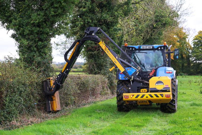
“We chose hedgerows as the focus for this project as they are a dominant but undervalued feature of western European farms,” Finneran explained as he announced the move.
“This is particularly the case in Ireland where they cover 6% of the land area, yet farmers are not given any credit for the biodiversity and carbon sequestration value of these hedges and treelines,” he said.
Digitisation
The technologies employed in the project have only become commercially viable in recent years, according to Farmeye co-founder Joe Desbonnet.
To provide farmers with the measurements that will soon be provided digitally would have previously been uneconomical.
“Technology has advanced hugely in this field (excuse the pun) in the last decade, to the point where the type of model we are developing here is very feasible and affordable,” he added.
SHARING OPTIONS