

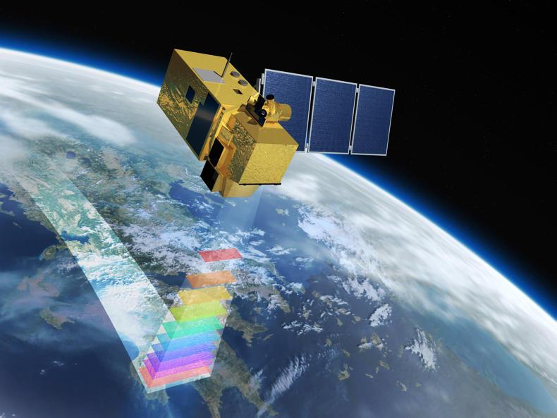
SPACE (satellite pasture and cover estimation) is the name given to the latest technology for measuring grass in New Zealand. As the name suggests, the technology uses satellite imagery for measuring grass covers.
“SPACE will tell farmers how much feed (grass) is in each paddock. Probably the biggest benefit for the farmer is the time saving and convenience of SPACE as they will know how much feed they have without having to walk the farm.”
That’s according to Rebecca Dalrymple from LIC. LIC has developed an algorithm to convert images of grass to actual pasture cover in kilograms of dry matter per hectare.
These satellites pass over New Zealand daily and when the weather is clear and a good image can be sourced, the technology will generate an average farm cover for the farm.
“There are so many satellites in the sky now that heavy cloud cover isn’t really a major problem. New Zealand is rarely fully covered in cloud all day, and when it isn’t cloudy the chances are there is a satellite waiting to take images,” Rebecca says.
“Like all other methods of pasture cover estimation, it’s not 100% accurate but what we do say is that it’s at least as consistent as a plate meter. As we know, pasture cover estimation is very person-specific, so the feedback we’re getting about the accuracy of SPACE is really awesome,” Rebecca says.
Cloudy weather
Because the satellites pass daily and LIC does not know when the next period of cloudy weather will be, a report is issued after every pass. For a farmer in New Zealand with 400ha or less, a yearly subscription to SPACE will set them back between $1,000 and $3,000 (€600 to €1,800).
For farms greater than 400ha, there will be an additional per-hectare charge. Rebecca says that the service will cost the average farmer in New Zealand about $2,500 (€1,500) for the year.
One of the main selling points of SPACE is the consistency of the measurements. Because there are no people involved in deciding the cover, there is no room for error or deviations from day to day or week to week.
Most farmers, no matter how experienced they are at measuring grass, will have different perceptions on how much grass is in a field.
Using SPACE will guarantee consistency from one measurement to the next – thus ruling out variations in human perception, particularly on farms with more than one employee.
The data is sent to the Land and Feed application in Minda Live, LIC’s herd recording system.
SPACE was developed by LIC scientists in conjunction with specialists from the US. The service has only been commercially available for the past five or six months and Rebecca says that the product will be refined and improved on an ongoing basis.
PastureBase Ireland
Teagasc has announced a series of new upgrades to the PastureBase Ireland app.
The app was launched earlier in the year and Micheal O’Leary from Moorepark says that while the app is basic it is functional.
Farmers need to have phone coverage or WiFi to download previous covers to the app. They can record a new cover on the app without internet access and then use phone coverage or WiFi at a later date to upload the covers to the database.
The fact that the app worked offline meant that it could be used in locations without a good phone signal.
An update to the app is expected this week, which will allow farmers to view the wedge and make management decisions on the app without having to connect to the website. Michael says that further improvements to the PastureBase website will be happening during the year.

SHARING OPTIONS